
Pertinent Information:
CalTopoMap Link: https://caltopo.com/m/121S94E
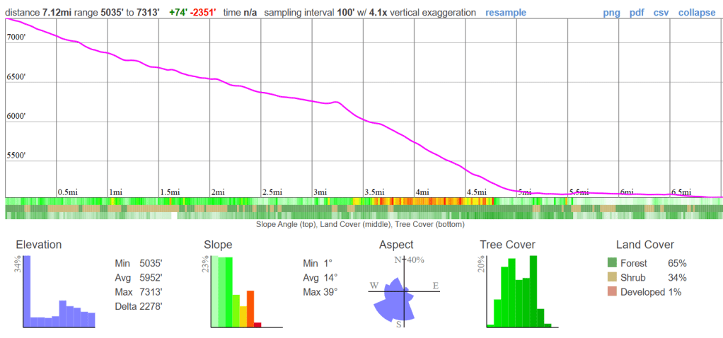
General Map with Elevation Profiles: Click Here
Garmin inReach MapShare: https://share.garmin.com/howtogetlost
Permit Information:
https://www.recreation.gov/permits/445857
https://www.nps.gov/seki/planyourvisit/wilderness_permits.htm
This post may be edited after the trip to better reflect the information as well as providing a trip report.
This post HAS been edited to share my post trip information and to make some minor corrections.
This is both a pre and post trip logistics report to provide the resources I am using for this trip.
It has been well over a decade since I have been to the Rae Lakes area, and I am pretty excited to be adventuring back in this area. For this trip, unlike the John Muir Trail (JMT), I will be coming in from the west (Rae Lakes Loop Trailhead) and joining up with the JMT via Woods Creek to then head south until we get to Rae Lakes. From there we will head over Glen Pass and work our way south along the JMT until the Bubbs Creek/Vidette Meadows junction. From here it’s a steady downhill all the way back to Roads End. The overall trip will be about 40 miles and we will spend three nights.
For route logistics and mapping I used a combination of my own knowledge of the area and CalTopo. This post will host all of my mapping information as well as my Garmin inReach information. Friends and family can also check in on this post to find the most recent information about this trip.
Route & Itinerary
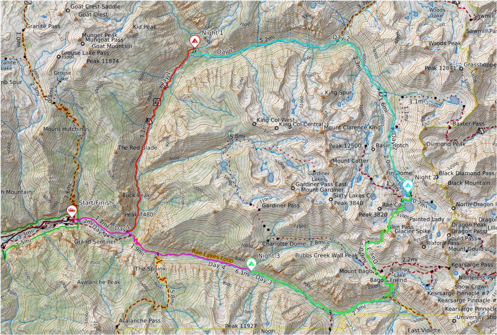
Day 0: Travel to Rae Lakes Loop Trailhead
Our first couple of days will involve travelling from southern California to Visalia. We will spend the night in Visalia and then drive up to the Rae Lakes Loop Trailhead. Overnight parking should be available at the trailhead with plenty of overflow parking in case it’s a particularly busy season. The trip from Visalia to the trailhead should take about two hours and we plan on being on the trailhead no later than 9:00 AM. Our first day was planned to be a shorter milage day to accommodate the later start due to travel.
Day 1: Rae Lakes Loop Trailhead – Upper Paradise Valley
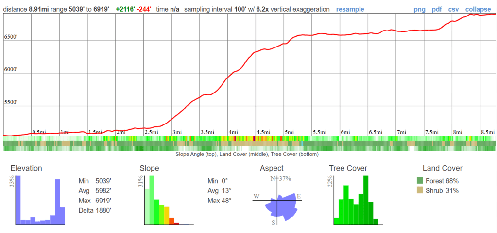
The plan here is to leave the parking lot of the Rae Lakes Loop Trailhead and make our way north towards Upper Paradise Valley. Though plenty of space is available at Upper Paradise Valley, this is also a busy time of year for Sierra backpacking and spaces may be limited. If spaces cannot be found, we will either go up or back down trail within a mile to find something.
Water at this location should be good. Temperatures will be a little warmer due to the lower elevation and the valley shape/exposure.
Day 2: Upper Paradise Valley – Rae Lakes
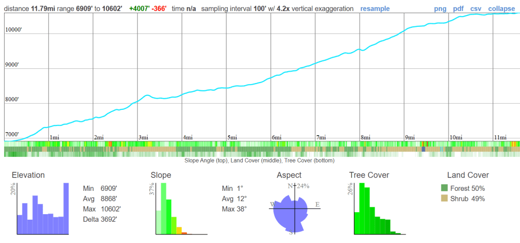
For the second day we will be making our way into Rae Lakes for the night. About half way through the day we will meet up with the John Muir Trail (JMT) and follow it south. We are expecting to see an increase in the amount of trail traffic at this point since it is August and prime season for thru-hiking the JMT and late season for the Pacific Crest Trail (PCT). The plan will be to stay somewhere along Rae Lakes proper, but this may change due to the amount of people in the area. Rae Lakes, from my experience (over a decade ago), should have plenty of available campsites.
Plenty of water is available at this location as these are year-round lakes. Temperatures will be slightly cooler that the previous day due to an increase in elevation. No weather is forecasted for this area.
Day 3: Rae Lakes – Bubbs Creek/Charlotte Creek
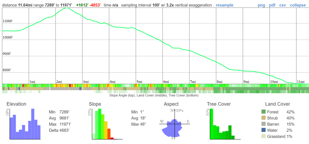
The third day will take us out of Rae Lakes and over Glen Pass. From here we will stay on the JMT until the Bubbs Creek/Rae Lakes Loop junction and then head west on the Rae Lakes Loop Trail. The goal for this day is to make it to where Charlotte Creek merges with Bubbs Creek and find camping in this area. I am unfamiliar with this area, but the topo maps support the possibility of finding camping here. If so, then our last day will be a nice easy and short day back to the parking lot. Everything after Glen Pass is downhill, so elevation gain won’t be an issue.
I am unsure about the water situation, but the live satellite information appears to be showing water. Also, this area has pretty steady year-round streams from snow melt over the summer. Temperatures will be a little higher from Rae Lakes due to the decrease in elevation.
Day 4: Bubbs Creek/Charlotte Creek – Rae Lakes Loop Trailhead
This is the final day of the loop/trip. From here we will be travelling from a spot near the Bubbs/Charlotte Creek merger back to the trailhead parking lot. Other than the notable decrease in elevation, there isn’t much to note about this day. Camping along the trail isn’t necessary, and if the streams are running decently, water shouldn’t be an issue either. This is a short day clocking in at about 7 miles.
Water and temperatures will be similar to the previous day.

Leave a reply to Cameron Townsend Cancel reply